|
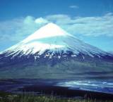
Volcanoes are mountains which are connected to the molten rock in the center of the earth. There are three types of volcanoes: cinder cone, shield, and composite cone. Each kind of volcano forms in a slightly different way but each one can erupt with amazing force.
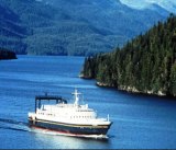
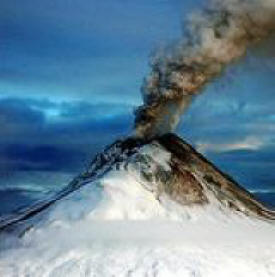
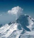
The 15 active volcanoes that line the Shelikof Strait make Katmai National Park and Preserve one of the world's most active volcanic centers today. These Aleutian Range volcanoes are pipelines into the fiery cauldron that underlies Alaska's southern coast and extends down both Pacific Ocean shores--the so-called Pacific Ring of Fire. This Ring of Fire boasts over four times more volcanic eruptions above sea level than any other region in our historic times.
Katmai was once a cluster of 3 or 4 small volcanoes. Novarupta, meaning "new eruption", is a volcano located on the Alaska Peninsula in Katmai National Park and Preserve, about 290 miles (470 km) southwest of Anchorage. Formed in 1912 during the largest volcanic eruption of the 20th century, Novarupta released 30 times the volume of magma as the 1980 eruption of Mount St. Helens.
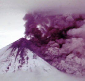
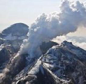
The most violent Alaskan eruption recorded occurred on June 1912 from Novarupta/Katmai Volcano. This was one of the world's largest in this century and brought widespread attention to Alaska's many volcanoes. On June 6th, 1912 a tremendous blast sent a large cloud of ash skyward and the eruption of the century was underway. People in Juneau, Alaska, about 750 miles from the volcano, heard the sound of the blast – over one hour after it occurred.
For the next 60 hours the eruption sent tall dark columns of tephra and gas high into the atmosphere. By the time the eruption ended the surrounding land was devastated and about 30 cubic kilometers of ejecta blanketed the entire region. This is more ejecta than all of the other historic Alaska eruptions combined. It was also thirty times more than the 1980 eruption of Mount St. Helens and three times more than the 1991 eruption of Mount Pinatubo, the second largest in the 20th Century.
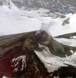
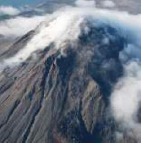
The eruption darkened the sky over much of the Northern Hemisphere for several days, and deposited a foot of ash on Kodiak Island, 100 miles away. When the eruption was finally over, more than 40 sq. miles of once lush, green land were buried under volcanic deposits as deep as 700 feet. Many small holes and cracks developed in the ash fall, which let gas and steam escape from heated ground below escape. The result was a landscape riddled by thousands of steam vents. When explorer Robert Griggs came to see the damage of the eruption in 1916, he was amazed at what he saw and named the area "The Valley of Ten Thousand Smokes." Today, the steam vents are gone, and the valley continues to recover. Visitors to the area can still see evidence of the eruption and are reminded of the awesome power and destruction volcanoes can unleash.
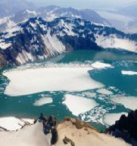
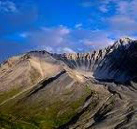
During the eruption a large amount of magma was drained from magma chambers below. The result was a removal of support from beneath Mount Katmai which is six miles from Novarupta. The top several hundred feet of Katmai - about one cubic mile of material - collapsed into a magma chamber below. This collapse produced a crater about two miles in diameter and over 800 feet deep.
Early investigators assumed that Katmai was responsible for the eruption. This assumption was based upon Katmai being near the center of the impact area, Katmai was visibly reduced in height, and early witness accounts thought that the eruption cloud ascended from the Katmai area. Closer observation was not possible and expeditions into the impact zone would be very difficult to accomplish.
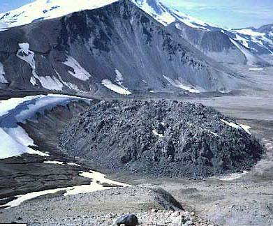
The first scientific investigation to get an up-close look at the eruption area did not occur until 1916 when Robert Griggs found a 2-mile-wide caldera where Mount Katmai once stood. He also found a lava dome at the Novarupta vent. These observations convinced Griggs that Katmai was the source of the eruption.
It was not until the 1950s - over forty years after the eruption - that investigators finally realized that ash and pyroclastic flow thicknesses were greatest in the Novarupta area. This discovery produced a revelation that Novarupta - and not Katmai - was the volcano responsible for the eruption
|